New District Na Kaménkách, Brno-Černovice
2017, combined competition, third prize
| In cooperation with Thomas Müller Ivan Reimann Architekten, Berlin | |
| Team: | Tereza Abrhámová, Barbara Bartoňková, Michaela Brychtová, Jan Foltýnek, Martina Holá, Jan Kozák, Thomas Müller, Filip Musálek, Petr Pelčák, Ivan Reimann, Jan Rolinc, Richard Sukač, David Vahala, Eva Wagnerová |
| Commissioner: | Statutary City of Brno |
| Photographs of the model: | Filip Šlapal |
Concept
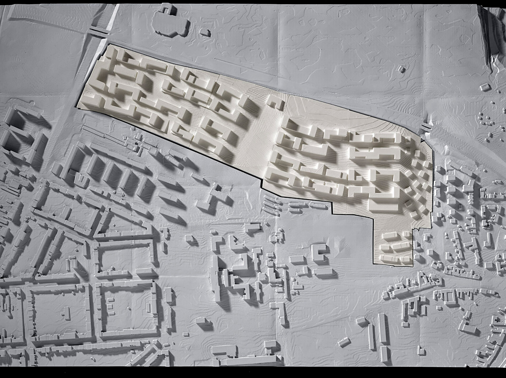
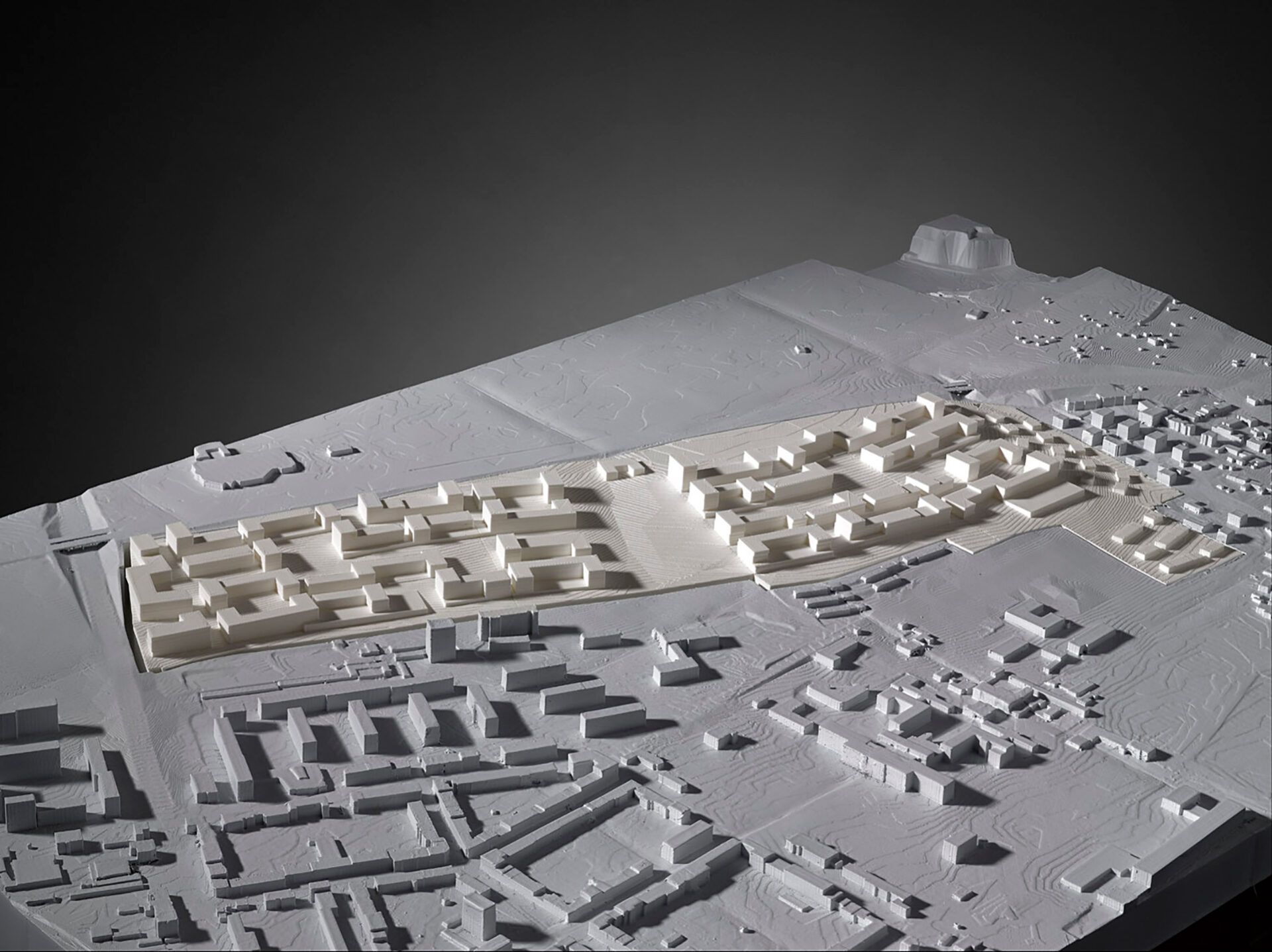
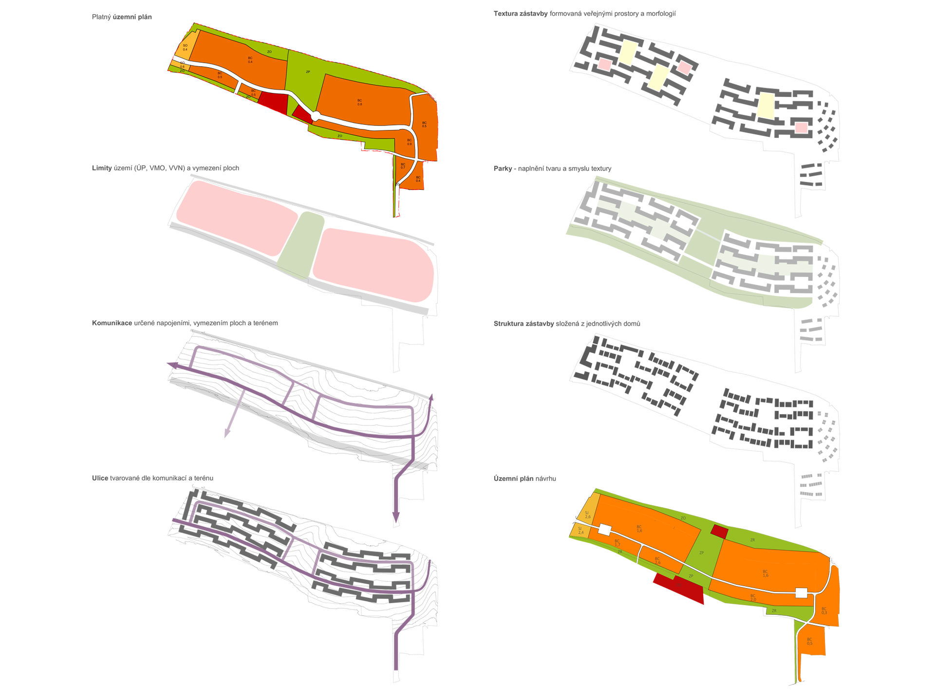
The architect was faced with a basic decision at the beginning of the design of this competition task: whether to create a structure of buildings or the city on a field on a slope in a suburban area. Our program is of a city character, that is treating the public space and defining both its character and its quality. The residential potential of the environment consequently depends on this.
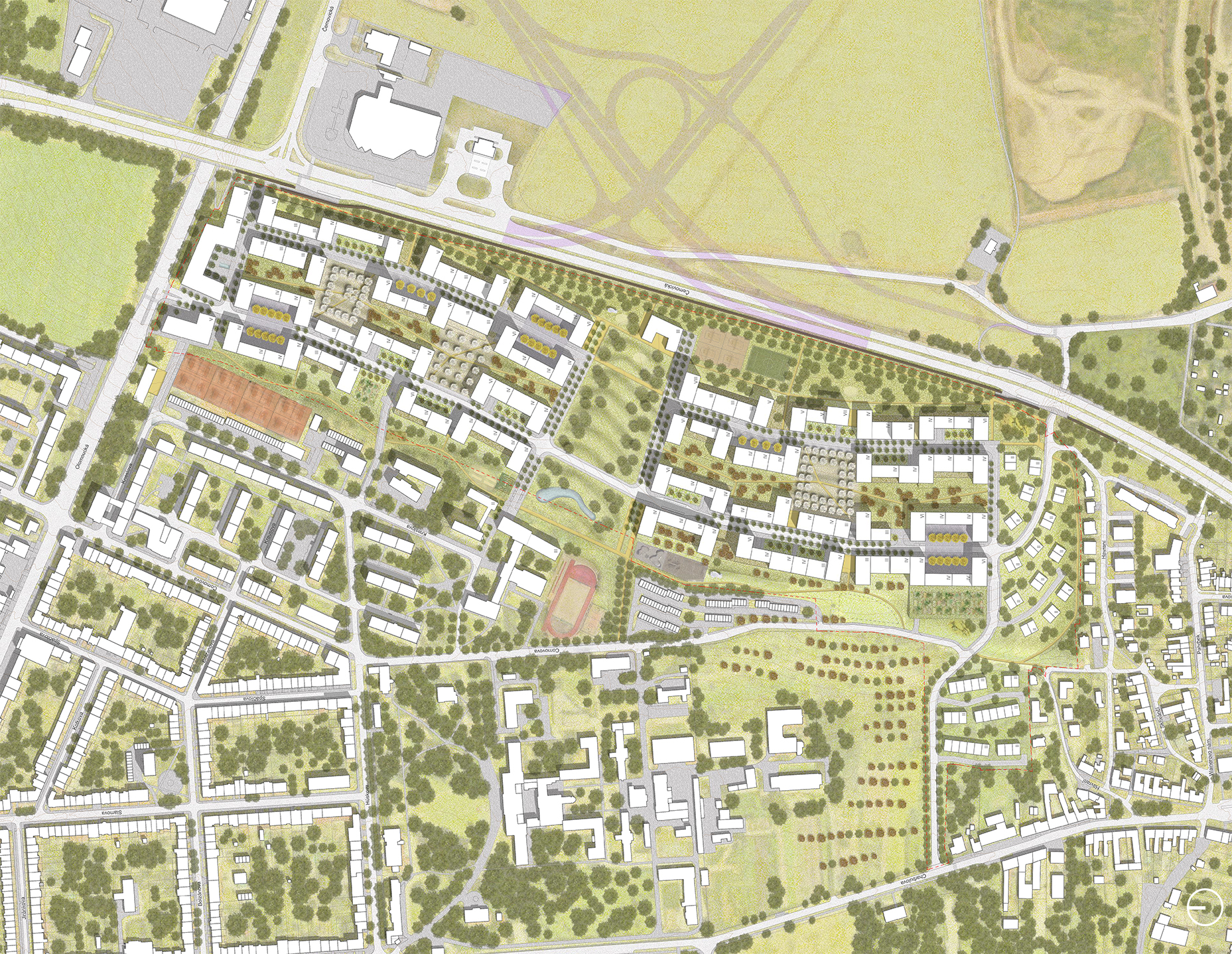
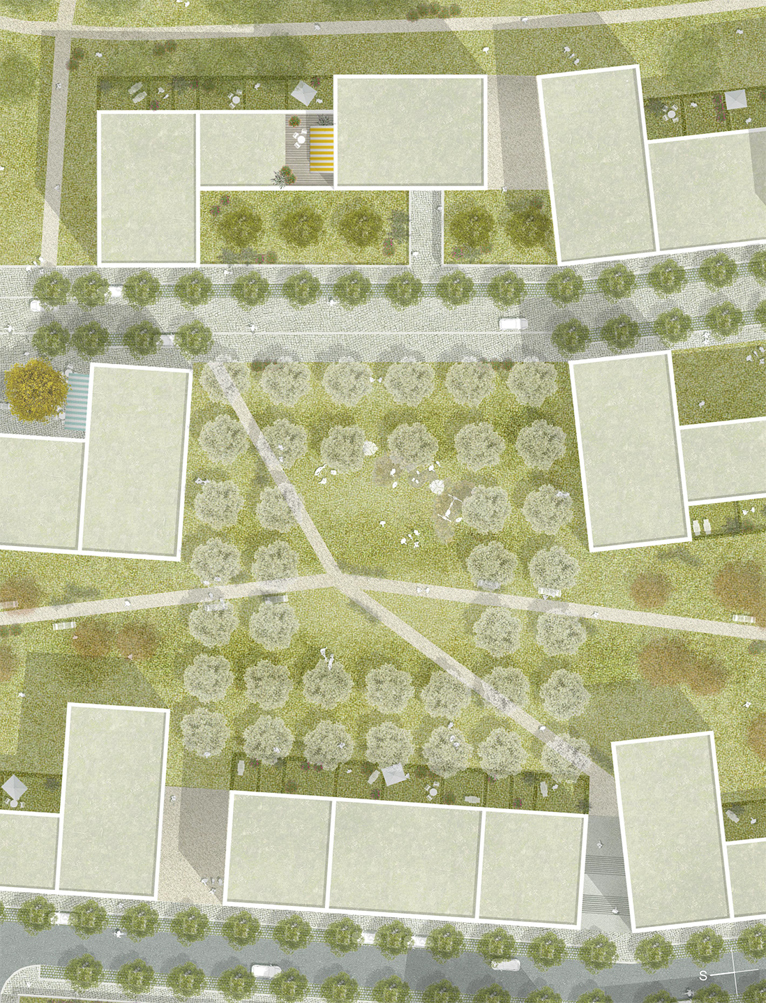
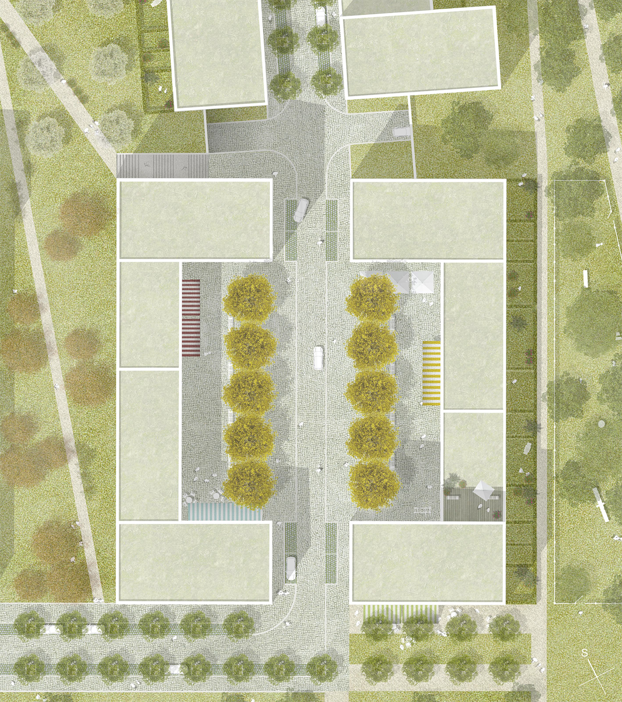
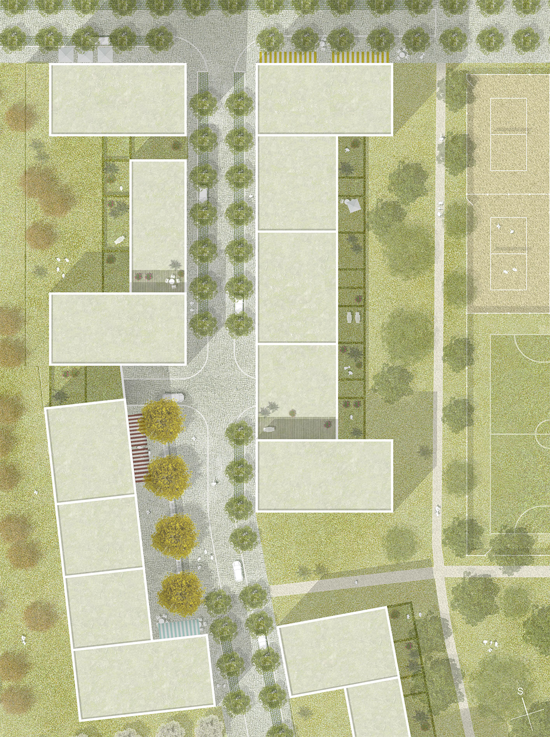
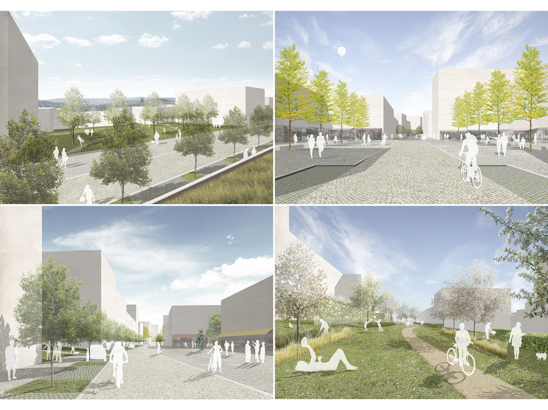
The form of the development is therefore defined by the public spaces, their position and the urban-planning typology. The platform of the design is a central park linking up the northern and southern locality of the territory and these two with Nové Černovice. Another three smaller parks outline the locality, form the vicinity and identically the three living squares – the gates of both localities. Everything is linked by the street of a varying profile: either narrowing or expanding with the surface of the gardens or grassy areas on the terraces in front of the entrances which enhance the privacy of the flats.
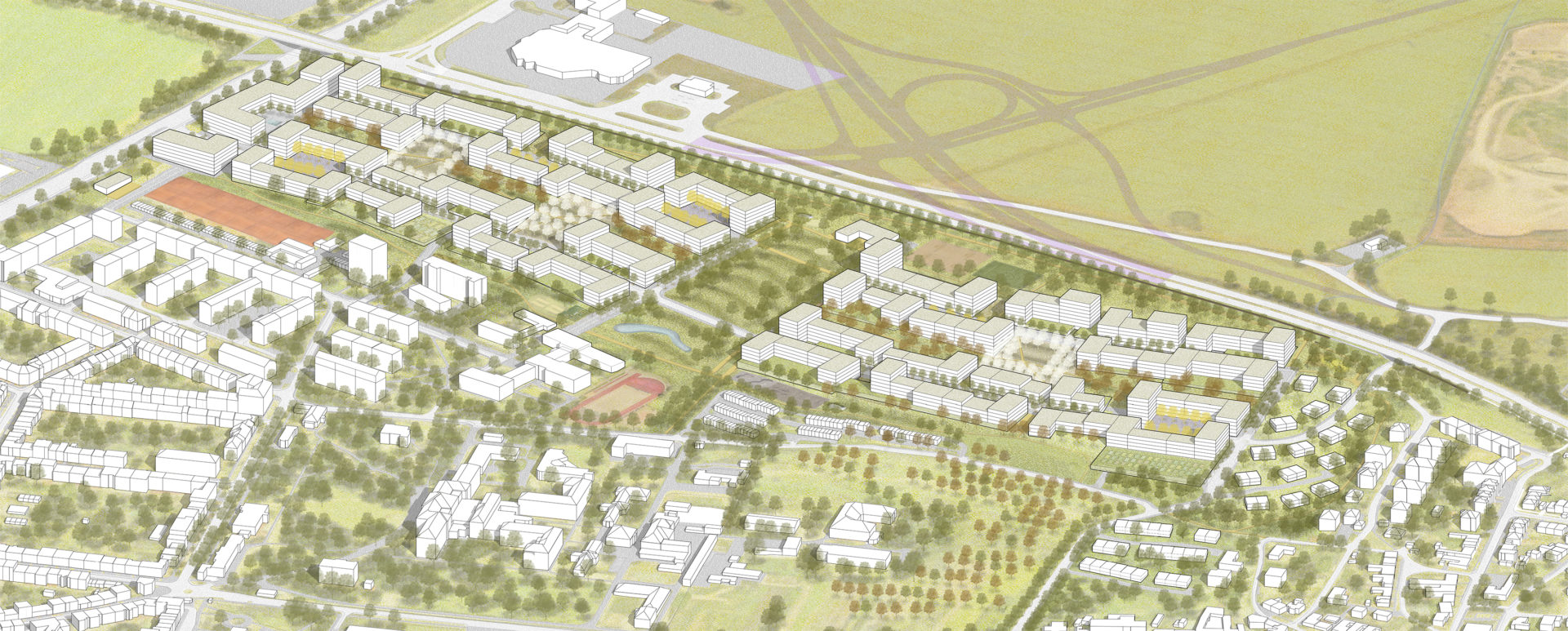
The design therein makes use of traditional urban-planning typological elements and situations and arranges them in a street skeleton. This creates an urban density of spatial experiences and offerings. The concrete characters of the locales consequently form the unity of the whole, as adding colourful beads on a string creates an attractive necklace. Since the aim of the design is to create communities or municipalities, basic clear and comprehensible elements and motifs are worked with: streets, a park, a square, a garden, a grassy area, a terrace and a passageway. These urban categories form the development and define the course of the street fronts. Since the designed territory is located in a suburban area, on a slope with views of the historical centre, street development with closed courtyards has not been created, but instead meanders in a park. This serves to establish the character of the locality as a contemporary garden city. And at the same time the park becomes its central public space, but a clear, safe space with constricted facades with the windows of the flats.
Town planning
The counterpart to the openness of the parks is the compact character of the structure which is the basis of the feeling of urbanism. The width of the street is derived from the design of Brno of the nineteenth century, which gave the city its current shape. The narrow passages of the block to the parks or the proximity of the facades or construction volumes are familiar from old cities, where one feels comfortable. At the same time, the design of the layout plan enables an otherwise problematic aspect of Czech construction legislation. The compact character brings a certain typological logic with it. The spatial clarity of the square is also supported by the living main floor of services and shops. The main park, in contrast, provides an open space and views of the city, with its form of open arms extending outward toward the Nové Černovice neighbourhood and linking up the old and new developments of the territory. This connection supports the institutions situated in the park which serve the entire city district: school, preschools, community centre, sports ground … Both long sides of the designed territory consist of protective zones without development – to the east due to noise from the city ring road and to the west for the high voltage lines. The design turns these belts into an attractive area of meeting points and links. A continuous ring of parks is designed along the circumference of the development area, supplemented by a range of “stops” involving sites for sports and relaxation activities. These will serve as a social space for the inhabitants of both of the new localities as well as for both the old and new parts of Černovice. The construction of residential houses is incorporated into the village texture of the Staré Černovice neighbourhood. The residential locality to the north at the Olomouc radial road is enclosed by blocks forming a neck, a gate to the territory. This is spatially linked to the entrance square with again a shopping main floor as well as a health facility integrated into the lower part with nursing services.
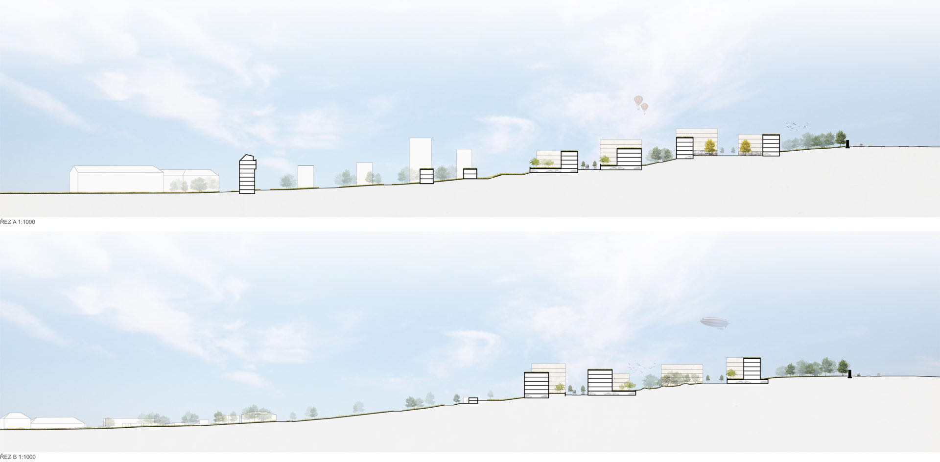
The form of the development is defined by the character of the public spaces as well as by the topography and morphology of the area. The construction structure aligns with the terrain, both in terms of shape, being led along layers, and literally holding it, being low-storeyed. The average height of the designed development is three storeys, but with significant differences between them. The plasticity and smaller scale which emerge with this modelling help create a living city environment and at the same time prevent the view of the development from blending into a uniform volume when seen from afar, additionally emphasizing the morphology of the area. Another important element in the distance perspectives is the “wall” of trees on the top of the hill along the road, creating a natural horizon. Another row of trees demarcates the public spaces (the central park), leading in a fall line and linking the area with the Černovice neighbourhood.
Territorial plan, stages
The design enables the immediate launching of the construction without changes to the territorial plan and can be realized in any form of stages, which the city and investors decide upon.
